GCTA Walking Farm
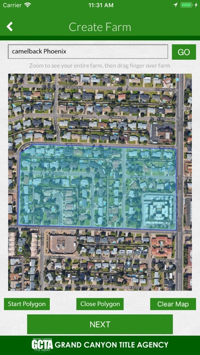
Using the Grand Canyon Title Agency Walking Farm App, you simply select the area you want to walk by drawing a line using your FINGERTIP through the properties on an aerial map in the order you intend to walk the Farm. When you are satisfied with your selection, the App will return a list of properties in walking order. Or draw a polygon area using your FINGERTIP to return information on all properties within that area. The information can then be managed from your device; notes can be added to each record for follow up activities.
Key features:
- Draw any organized path to fit your walking needs
- Draw a polygon to return properties within that area
- Detailed Ownership Information for each property
- Owner Occupied or Absentee Owner clearly displayed
- Notes can be added to each farm record
- Farm record order can be adjusted if needed
- Farm can be exported
- See statically information of your farm
- Farm can be drawn from any location (In the office or in the field)
- Multiple Farms can be saved
- Ability to pull Property Profile and Documents on most farm records
- Ability to start walking your farm from a Map View
* An active MyGCTA account is required; contact your local Grand Canyon Title Agency Sales Executive for more information. Internet connection required, data rates may apply.


